
The Hills of Cincinnati
- Oct 14, 2021
Years ago, our very own Krohn Gift Shop sold a t–shirt that read, Ski Cincinnati. It featured a graphic of a “mountain range” with each hill labeled Mt Echo, Mt Adams, Mt Auburn, etc.
Looking north across the river from Covington, it isn’t as easy to see our city’s unique topography. This lithograph below, from 1800, showcases the untouched landscape and we can easily imagine how our neighborhoods were given names like “Price Hill” or “Clifton Heights.”
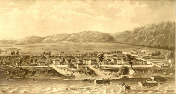
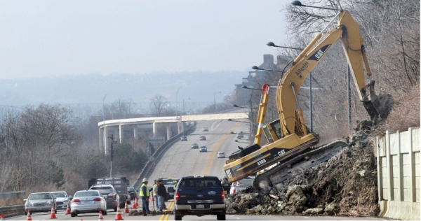
The story of Cincinnati’s hills is, well, as old as the hills! During the ice age, very large glaciers reached the tip of our area. As the ice melted, the water carved through the flat plain creating deep ravines and valleys, thus leaving behind what appear to be our series of “hills” that we now call our neighborhoods. This can be observed in such places as the top of the hill at French Park and Alms Park. When looking across the valleys, the other surrounding height apexes are at the same level. Those events in earth’s history also formed the current Ohio River. The erosion that took place because of the glacial melt also washed away many newer layers of rock and soil to expose some of the earliest Ordovician fossils found on earth. Some erosion occurs even today, and we can see evidence of that because we have built roads and buildings into these hillsides. So the next time Elberon Avenue or Columbia Parkway are closed off due to a mudslide, you can think of the ancient processes that started it all.
Written by: Jonathan Duerbeck, Naturalist